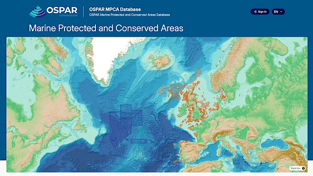
| | Exploring OSPAR’s network of protected and conserved areas became easier this week, as the OSPAR Commission launched its new Marine Protected and Conserved Areas Database and Map Explorer, giving policymakers, scientists and the public a more powerful way to explore the region’s network of area-based conservation measures.
The new platform brings together detailed information on over 600 MPAs of the OSPAR network, combining interactive maps, site profiles and up-to-date statistics on coverage, management and ecological coherence. Users can search individual protected areas, view spatial data, and filter by protected species or habitat.
The upgrade replaces a system that has been in service since 2013 and will support more efficient reporting, data sharing and transparency. It also prepares OSPAR for the growing role of Other Effective Area-Based Conservation Measures (OECMs) alongside traditional MPAs.
OSPAR’s work is driven by its goal to further develop its network of marine protected areas (MPAs) and other effective area-based conservation measures to cover at least 30% of the OSPAR maritime area by 2030 while remaining representative, ecologically coherent and effectively managed to achieve their conservation objectives.
By providing a clearer picture of where protections are in place and how the network is evolving, the new database and map explorer will help Contracting Parties, scientists and stakeholders monitor progress and identify opportunities to strengthen marine conservation across the region.
EXPLORE: https://mpca.ospar.org/ |
| | |
|