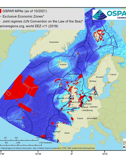
OSPAR MPA database and webtool
The OSPAR MPA database holds spatial and non-spatial data on MPAs that have been nominated to the OSPAR MPA network and can be accessed through the OSPAR MPA database webtool.
Key statistics on the OSPAR MPA network are continuously calculated based on information in the database and presented through the webtool. The up to date number of MPAs nominated by each Contracting Party as well as calculation of MPA coverage per Contracting Party, ABNJ and the entire OSPAR maritime area are presented. Statistics on ecological coherence, management issues and OSPAR threatened and/or declining species and habitats protected by the network are also presented.
Information about each of the MPAs included in the OSPAR MPA network can be browsed as data sheets.
Spatial information held in the OSPAR MPA database and accessible through the webtool, are also displayed in ODIMS.
The information held in the OSPAR MPA database has been reported by Contracting Parties when nominating a new MPA to the network and/or as an update in the annual data call for implementation reporting. The information held in the database is used to undertake regular assessments of the status of the network, presented as a biennial status report of the network and an annual assessment sheet.
The OSPAR MPA database is co-administered by Agence française pour la biodiversité and Bundesamt für Naturschutz.


